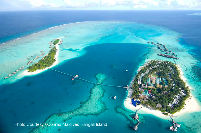
Maldives from the top
Maldives beautiful beach
Night in Maldives
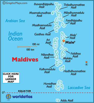
Map of Maldives
Location : Male, Republic of the Maldives.
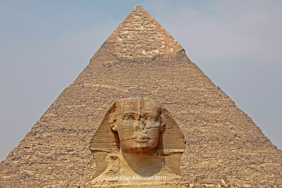
Maldives, officially
the Republic of the Maldives and also referred to as the Maldive Islands, is
an island nation in the Indian Ocean-Arabian Sea area, consisting
of a double chain of twenty-six atolls, oriented north-south, that lie between Minicoy Island (the southernmost part of Lakshadweep, India) and the Chagos Archipelago. The chains stand in the Laccadive Sea, about 700 kilometres south-west of Sri Lanka and 400 kilometres south-west of India. The Maldives
is the smallest Asian country in both population
and land area. With an average ground level elevation of 1.5 metres above sea
level, it is the planet's lowest country. It is also the country
with the lowest natural highest point in the world, at
2.4 metres. Forecasts
predicting future inundation of the Maldives due to rising sea levels are of great
concern to its people.
Oldest Mosque in Maldives (Hukuru miskiy)
Most
of the Maldives communities are Muslim. The famous Moroccan traveller Ibn Batutta, who visited the Maldives in the 14th century,
wrote how a Moroccan, one Abu Barakat the Berber, was believed to have been responsible for spreading Islam
in the islands. Even though this report has been contested in later sources, it
does explain some crucial aspects of Maldivian culture. For instance, historically
Arabic has been the prime language of administration there, instead of the
Persian and Urdu languages used in the nearby Muslim states. Another link to
North Africa was the Maliki school of
jurisprudence, used throughout most of North-Africa, which was the official one
in the Maldives until the 17th century.
Oriental Sweetlips Sea Hibiscus
Maldives consists of 1,192 coral islands grouped in a
double chain of 26 atolls, along the north-south direction, spread over
roughly 90,000 square kilometres, making this one of the world's most dispersed
countries. Maldives
waters are home to several ecosystems, but are most noted for their variety of
colourful coral reefs,
home to 1100 species of fish, 5 species of sea turtles,
21 species of whales and dolphins, 187 species of corals, 400 species of
molluscs, and 83 species of echinoderms. Many crustacean species are there as
well 120 copepod, 15 amphipod as well as over 145 crab and 48 shrimp species.
Resort in Maldives
The Maldives remained largely unknown to
tourists until the early 1970s. Only 185 islands are home to its 300,000
inhabitants. The other islands are used entirely for economic purposes, of
which tourism and agriculture are the most dominant. Tourism accounts for 28%
of the GDP and more than 60% of the Maldives' foreign exchange receipts. Over
90% of government tax revenue comes from import duties and tourism-related
taxes. The development of tourism fostered the overall growth of the country's economy. It
created direct and indirect employment and income generation opportunities in
other related industries. The first tourist resorts were opened in 1972 with
Bandos island resort and Kurumba Village, which transformed the Maldives economy.
The number of resorts increased from 2 to 92 between 1972 and 2007. As of 2007,
over 8,380,000 tourists had visited Maldives. Tourism was also the
country's biggest foreign currency earner and the single largest contributor to
the GDP.


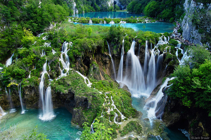
 Most incredible waterfall !!
 Map of Angle Falls


 Beautiful Lake